


State of emergency issued: Hurricane Matthew's track shifts west
Hurricane Matthew's track shifts west
By Don Schwenneker and ABC11
Updated 1 hr 6 mins ago
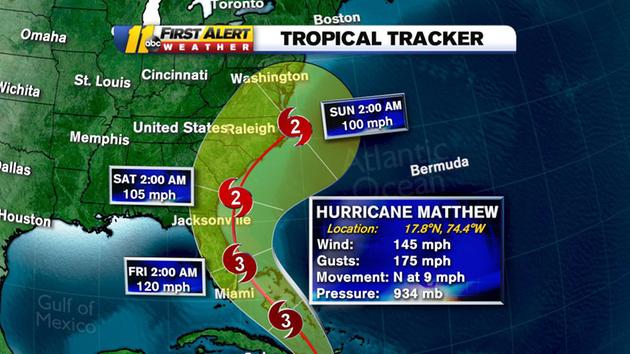
RALEIGH (WTVD) -- Gov. Pat McCrory has issued a state of emergency for 66 North Carolina counties - which includes the entire ABC11 viewing area - as Hurricane Matthew swirls closer. The 5 a.m. update from the National Weather Service shows Hurricane Matthew's track continues it's slight shift to the west, putting the Triangle, including the city of Raleigh, in the cone projection.
The governor said officials are taking the storm very seriously and are hoping to be "over-prepared and underwhelmed by Hurricane Matthew."
Watch Gov. McCrory's full press conference
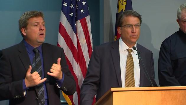
Gov. McCrory spoke Monday and said he's declared a state of emergency in 66 NC counties
"I'm hoping this is a false alarm - but we can't gamble, we won't gamble with people's lives and livelihoods," said McCrory.
Matthew is a potentially devastating Category 4 storm with sustained winds of 145 miles per hour, packing gusts up to 175 miles per hour.
"Computer model track forecasts are showing a disturbing trend towards the west," says ABC11 Chief Meteorologist Chris Hohmann. "Many models are now forecasting a landfall somewhere in eastern North Carolina by the weekend."


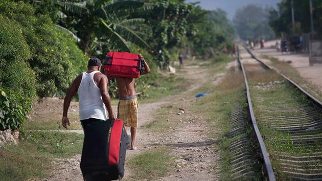
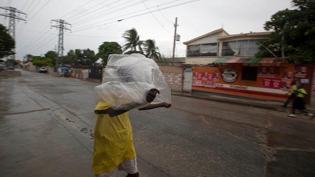

Families seeking shelter ahead of Hurricane Matthew arrive at the university in Guantanamo, Cuba, Monday, Oct. 3, 2016. (Ramon Espinosa/AP)
Matthew is currently in the Caribbean, about 35 miles south of Tiburon, Haiti and 165 miles south of the eastern tip of Cuba. It was moving north near 9 mph.
"By Saturday morning it could be anywhere from Georgia & South Carolina, all the way out to sea," says ABC11 Meteorologist Don 'Big Weather' Schwenneker. "There's just a lot of uncertainty with this right now and to make a forecast on where it would go just wouldn't be right."
Some models show the storm hundreds of miles offshore. That would be the best solution but this far out it's all speculation. Others bring it right up through central North Carolina.
McCrory stressed in his news conference that they are starting preparations early despite being unsure of the hurricane's path.
Duke Energy is on alert as they track the storm's path. They say they're preparing for a major power outage event.
"We have sophisticated systems that can take the weather forecasts that we're seeing and actually develop a modeling scenario to determine the expected outages- where they'll be most likely concentrated," said Jeff Brooks, a Duke Energy spokesperson.
The state's largest energy provider hasn't had to prepare for this kind of potential storm, in some time.
"It's been a while since we've seen a Category 3. That's in the "Fran" category, if you will, so it's a sizable storm," Brooks said.
The Outer Banks could see some problems even it stays out to sea. And I wouldn't plan on going in the water at the beaches this weekend. Rip currents will be a problem Friday, Saturday, and Sunday.
The Red Cross is urging residents in Eastern North Carolina to be prepared.
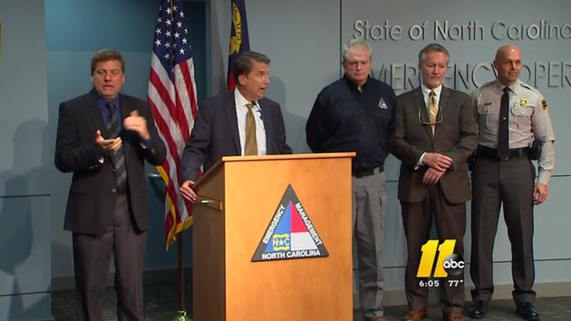
Gov. Pat McCrory and NC officials said they are preparing for the storm
"The better prepared folks are, the safer they will be should Hurricane Matthew impact our coastline," said Barry Porter, regional chief executive officer of the Red Cross in Eastern NC. "The Red Cross encourages residents to build a kit of necessities, ready their homes, and make a plan with their families."
Gov. McCrory said that officials are concerned about damage on the coast and inland because the ground is already saturated and river levels are high.
We'll have a much better idea on the path northward by Wednesday evening. By then, the storm will have passed over Cuba and that could significantly impact the northward path.