MEC&F Expert Engineers : 09/10/18

Monday, September 10, 2018

Guo Song Lu, 72, of Holmen, and Julie Macomber, 70, of Augusta, died after a milk truck driven by Brian Lee, 61, of La Crosse hit the vehicle driven by Macomber head on in Holmen, Wisc.


Holmen, Wisc.
 
The La Crosse County Sheriff’s Office released the names of the victims in Saturday’s fatal crash north of Holmen.

The two people, Guo Song Lu, 72, of Holmen, and Julie Macomber, 70, of Augusta, died in the crash at the intersection of Highway 53 and Sylvester Road shortly before 3 p.m. 


According to the Sgt. Michael Valencia, a milk hauler driven by Brian Lee, 61, of La Crosse, was northbound on Highway 53 when a vehicle driven by Lu pulled out from Sylvester Road. The two vehicles collided. While Lu’s vehicle stopped along a guardrail, the milk hauler continued northbound. It crossed over the center line and hit the vehicle driven by Macomber head on.

As the truck went through a guardrail, it was hit by a fourth vehicle driven by Paul Weir, 53, of Galesville.

The hauler continued over an embankment where it overturned.

Both Lu and Macomber died at the scene. Neither Lee or Weir were injured.


===============================


HOLMEN, Wis. (AP) — 


Two people have died in a crash involving three vehicles and a milk truck.
 
The La Crosse County Sheriff's Office says the crash happened Saturday afternoon on Highway 53 north of Holmen. A large milk truck traveling north on Highway 53 was struck by a vehicle which caused two additional vehicles to crash.

Drivers in two of the vehicles were killed. The chain reaction crash closed Highway 53 for several hours.

OSHA cited Harrison Industries LLC - operating as Structural Wood Systems Inc. - for exposing employees to multiple hazards at its Greenville, Alabama, worksite. The company faces $85,362 in proposed penalties.


U.S. Department of Labor Cites Alabama Woodworking Company For Exposing Employees to Fire and Explosion Hazards


GREENVILLE, AL – 


The U.S. Department of Labor's Occupational Safety and Health Administration (OSHA) cited Harrison Industries LLC - operating as Structural Wood Systems Inc. - for exposing employees to multiple hazards at its Greenville, Alabama, worksite. The company faces $85,362 in proposed penalties.

OSHA cited the woodworking manufacturer for failing to ensure employees used protective eyewear and respirators, implement a respiratory protection and permit-required confined space program, and use guards on a motorized roller conveyer table; and for allowing combustible wood dust to accumulate, exposing employees to fire and explosion hazards. The inspection was conducted under OSHA's National Emphasis Program on Combustible Dust and the National Emphasis Program on Amputations.

"This investigation is an example of why employers must implement effective safety and health programs to identify and address recognizable hazards that can cause serious injuries to employees," said OSHA Mobile Area Office Director Joseph Roesler.

Structural Wood Systems has 15 business days from receipt of the citations and proposed penalties to comply, request an informal conference with OSHA's area director, or contest the findings before the independent Occupational Safety and Health Review Commission.

Under the Occupational Safety and Health Act of 1970, employers are responsible for providing safe and healthful workplaces for their employees. OSHA's role is to help ensure these conditions for America's working men and women by setting and enforcing standards, and providing training, education, and assistance. For more information, visit https://www.osha.gov


Welcome to Structural Wood Systems


Structural Wood Systems is a single source supplier capable of satisfying all your requirements for glued laminated timber (glulam), from your initial inquiry through delivery of the finished product.
 

A worker employed by Kern Construction died after the boom lift in which he was standing tipped over at a work site in Bode, Iowa and crushed him the death


OSHA investigating Aug. 31 death at Bode work site
Man died when telehandler tipped at NEW Cooperative

September 7, 2018

Chad Thompson
cthompson@messengernews.net
  

BODE, IOWA — 


A man died after the boom lift in which he was standing tipped over at a work site in Bode.

Humboldt County Sheriff Dean Kruger said the accident happened while the boom lift was extended 50 feet off the ground.

The accident was reported at NEW Cooperative in Bode on the afternoon of Aug. 31.

According to Kruger, the man was standing on the platform of a telehandler.

Another man was attempting to drive the boom while it was fully extended, Kruger reported.

“The telehandler tipped over, causing fatal injuries,” Kruger said in a written statement.

Officials have not released the men’s names.

According to Mark Walter, NEW Cooperative grain manager, the men were not employees of NEW Cooperative.

The Iowa Occupational Safety and Health Administration has opened an investigation regarding the accident, according to Deborah Babb, a public service manager for OSHA.

Babb oversees safety compliance officers in the state.

OSHA requires employers to contact them within eight hours of a fatality.

Babb said OSHA was investigating Kern Construction, of West Bend.

A man who answered the phone for Kern Construction confirmed the two men were employees of the firm, but declined to comment further.

Bode firefighters, Humboldt Ambulance and the Humboldt County Sheriff’s Department responded to the accident at 4:22 p.m. on Aug. 31.


Kern Construction is a privately held company in West Bend, IA and is a Single Location business.

Categorized under Home Builders. Our records show it was established in 2008 and incorporated in Iowa. Current estimates show this company has an annual revenue of 171074 and employs a staff of approximately 2.

MISERY IN MISSOURI: Greene County Sheriff's Deputy Aaron Paul Roberts drowned after his car was washed off the road by rushing waters near the Greene and Dallas County line, Missouri


MISERY IN MISSOURI:  Greene County Sheriff's Deputy Aaron Paul Roberts drowned after his car was washed off the road by rushing waters near the Greene and Dallas County line, Missouri


MISERY IN MISSOURI:  Greene County Sheriff's Deputy Aaron Paul Roberts drowned after his car was washed off the road near the Greene and Dallas County line, Missouri

On September 7, 2018, Deputy Aaron Paul Roberts cleared a 911 call in the 9500 block of Farm Road 2. He was returning to service and moments later radioed that his car was washed off of the road. Several agencies assisted in rescue efforts.

A short time later, Deputy Roberts was found near his patrol car deceased. We ask that you please keep Deputy Roberts’ family in your prayers during this difficult time


UPDATE: Greene County Sheriff Gives Briefing After Death of Deputy

By: Cortlynn Stark Carrie Winchel


  September 7, 2018


Update (1:33 a.m.)

GREENE COUNTY, Mo. -- During a news briefing early Saturday morning, Greene County Sheriff Jim Arnott shared that Deputy Aaron Roberts, who was killed in rushing waters near Fair Grove Friday, had been with the department for about a year. Roberts was 35 years old.

Arnott told KOLR10 Deputy Roberts was checking on an abandoned 911 call on Cabin Creek Road Friday night. He returned to service, then radioed that his car was washed off the road.

According to Sheriff Arnott, it took more than an hour, maybe a couple hours, after hearing Deputy Roberts' car was washed away, before his vehicle and body were found.

The car was about 50 yards downstream, and about 100 feet off the road when it was found. The car was underwater for a period of time. Arnott said Roberts never made it out of his vehicle.

The Sheriff said the area where the Deputy's car was overtaken is notorious for dangerous flooding. Arnott said water there can often be deeper than it appears in that area, and water could get as deep as six to eight feet.

Rescue boats from the Springfield Fire Department Rescue Team were deployed in the search for Roberts, but they had trouble maneuvering in the water. Deputies and firefighters walked the banks in search of Roberts.

Arnott told KOLR10 law enforcement is one large family. He said agencies across the state, and even the nation, have already reached out to his department. The department will provide counseling for Roberts' colleagues. "We'll lean on each other, and we'll go through it, we'll have help from the community," Arnott said.

Arnott described Deputy Roberts as energetic, a man who loved his job and Greene County. Arnott said Roberts had formed deep bonds within the department and the community, and that he would be missed. Roberts worked as a police officer in Willard before serving in Greene County. He leaves behind a wife and a 7-year-old child.

Update (12:33 a.m.):

GREENE COUNTY, Mo. -- The Greene County Sheriff's Department confirms a deputy died when his patrol car was washed off the road Friday night.

In a tweet, the department confirms Deputy Aaron Paul Roberts cleared a 911 call on Farm Road 2 near Fair Grove.

As he returned to service, he radioed that his car was washed off the road.

A short time later, the body of Deputy Roberts was found near his patrol car.


Update (10:45 p.m.):

GREENE COUNTY, Mo. -- The Greene County Sheriff's Office has lost contact with a deputy who radioed in that his car was washed off the road.

According to the sheriff's office, the deputy cleared a call in the 9500 block of Farm Road 2. As he was returning to service, the deputy radioed in that his car was washed off the road. The Greene County Sheriff's Office tweeted that it has not found the vehicle or been able to contact the deputy.

Original story:

GREENE COUNTY, Mo. -- A water rescue is in progress near the Greene and Dallas County line.

Dispatch confirmed the rescue is ongoing near Farm Road 221 and Farm Road 2.

We have a reporter headed to the scene to bring you the latest.

Volunteer Firefighter, David Fischer, 43, of Sturgis, SD died Friday afternoon from an exploding propane tank while fighting a structure fire and searching for an unaccounted for person during a blaze in the Tilford area of South Dakota


SD Guard soldier killed while responding to Tilford house fire

RAPID CITY, S.D. – A South Dakota National Guard soldier was killed Sept. 7 while responding to a house fire in Tilford as a member of the Sturgis Volunteer Fire Department.

Staff Sgt. David Fischer, 43, of Sturgis, a survey team member with the Rapid City-based 82nd Civil Support Team, was killed Friday while battling the fire with the SVFD and local first-responder agencies.

Fischer served as the SVFD assistant chief and was a 22-year member of the department.

“The South Dakota National Guard family, along with the firefighting and first-responder community, are mourning the tragic loss of Staff Sgt. David Fischer who died in the line of duty protecting his community,” said Maj. Gen. Tim Reisch, adjutant general of the SDNG. “Our thoughts and prayers are with David and his family during this difficult time.”

Fischer, a 23-year veteran of the SDNG, leaves behind a wife and seven children. Fischer is an Iraq war veteran and deployed with the 216th Engineer Detachment (Firefighting Team) in 2004-2005.

“David exemplified what it means to be a soldier, firefighter and first responder – a self-less person willing to put his life in danger to help and defend his community, state and nation,” said Reisch. “He will be deeply missed.”

“Staff Sgt. Fischer was an original member of the 82nd Civil Support Team when it became a full-time unit in 2005 and instrumental in standing up the team,” said Lt. Col. Dale Gadbois, 82nd CST commander. “He was one of the finest soldiers I knew who would help anyone and everyone in times of need. From the beginning it was obvious he put his service before himself and paid the ultimate price rushing in to help the community in an emergency. It was an honor to have served with him the past 13 years.”

Funeral services are pending at this time and will be announced at a later date.

=====================================


A local firefighter died Friday afternoon while fighting a structure fire and searching for an unaccounted for person during a blaze in the Tilford area.


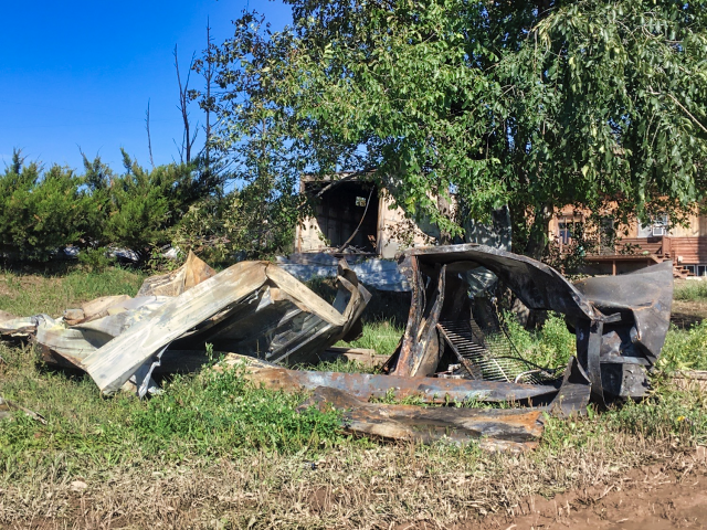
As the structure burned, the fire moved to a nearby propane tank, causing it to explode. A firefighter was killed in the explosion.


A Meade County Sheriff's deputy was also transported to the hospital while fighting the fire and a civilian remains unaccounted for, according to Rapid City Fire Department Lt. Jim Bussell.


Sturgis Fire Department was dispatched just after 4 p.m. to the small community of Tilford between Rapid City and Sturgis for a report of a structure fire.


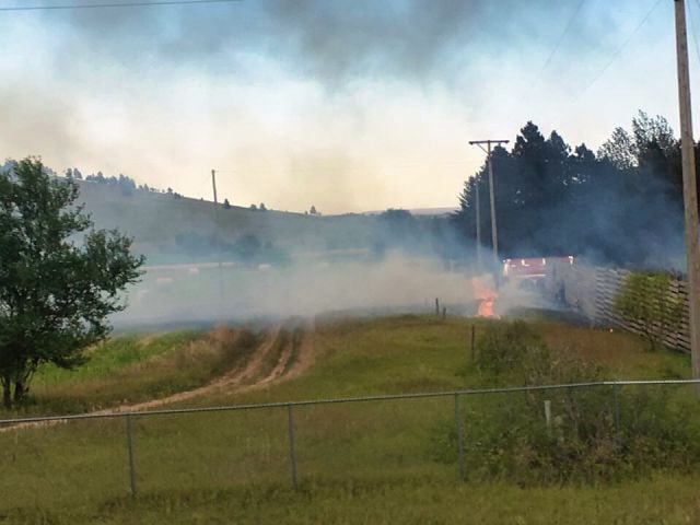
When firefighters arrived they found the structure fully involved and the fire was spreading to other outbuildings in the area. Crews continued to fight the blaze late Friday night.


Bussell said one firefighter "died in the line of duty," while fighting the blaze and a Meade County Sheriff's Deputy was transported to the hospital with non-life-threatening injuries. There is also one civilian who is unaccounted for at this time.


No information is being released about the deceased firefighter on Friday in order to first notify their family.
ADVERTISING
inRead invented by Teads


Bussell said the initial structure is completely destroyed along with several outbuildings, but fire crews don't have an accurate number on the full scope of the damage because crews are still working to fight the fire.


The fire crews had to deal with downed power lines, several propane tanks and other dangers while fighting this fire.


Several agencies have been called in to investigate the fire, including the ATF, but citizens shouldn't draw conclusions from the agencies involved, according to Bussell.


Subscribe to Daily Headlines

Get a daily summary of the news every morning

* I understand and agree that registration on or use of this site constitutes agreement to its user agreement and privacy policy.


"With a fire of this size and scope, including a fatality, it's common for these types of agencies to be called in," Bussell said.


The cause is unknown at this time.


Bussell is acting as the Public Information Officer on the fire and is speaking for multiple agencies responding to the fire.


More information is expected to be released Saturday morning after a 9 a.m. press briefing.


=====================================


Firefighter's name released from Tilford propane explosion 


September 10, 2018

By ALYSSA HENSRUD

Photos By DOMINIK DAUSCH


TILFORD, S.D. - 


The latest on a propane explosion in Tilford, S.D.


Sept. 8

Just after 4 p.m. on Friday, Sept. 7, the Sturgis Volunteer Fire Department was dispatched to the scene of a structure fire in the community of Tilford, S.D.

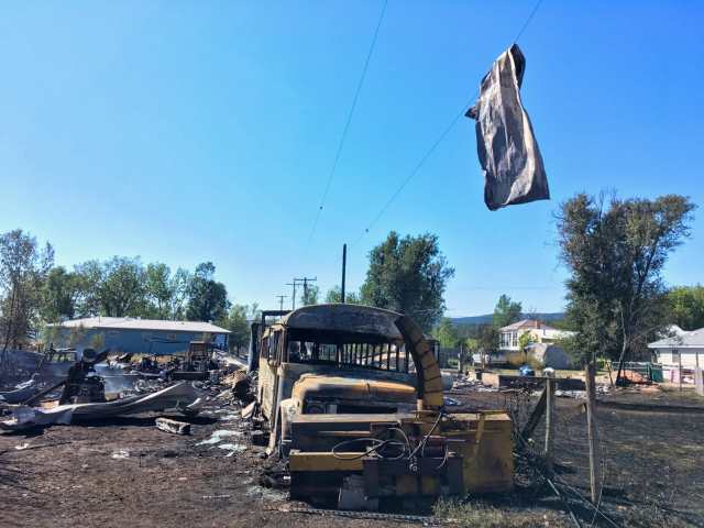
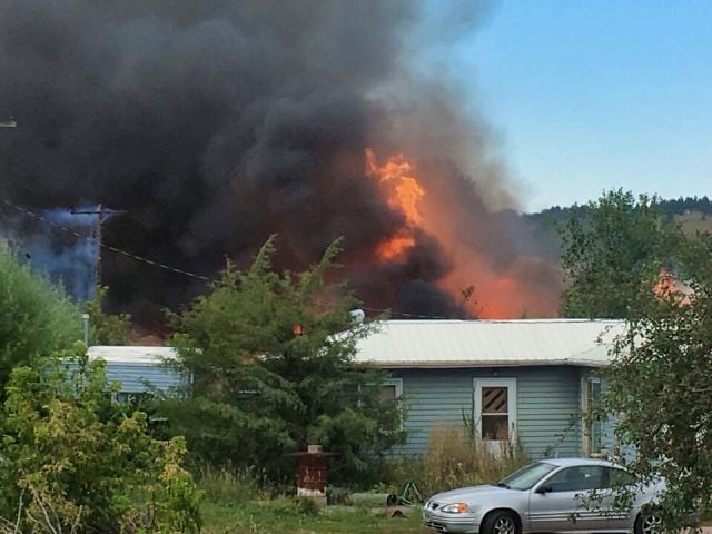
A large column of smoke was visible for several miles. When firefighters arrived on the scene, a single family dwelling was fully engulfed with several outbuildings threatened and involved, including several propane tanks.

Residents in the area were evacuated and additional resources summoned from nearby area fire departments.

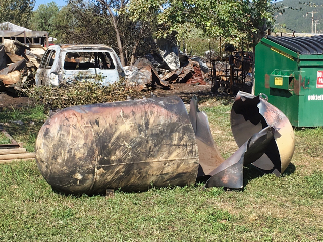
As firefighters were briefing the additional support on the scene and searching for an unaccounted person who was last seen in the involved residential structure, a nearby propane tank experienced a "catastrophic failure" and ruptured. Resulting in a large explosion.

As a result of this explosion, a firefighter was killed when shrapnel penetrated through his personal protective equipment. A deputy sheriff was also injured.


The firefighter who passed in the fire has been identified as 43-year-old David Fischer of Sturgis. Fischer, a 22-year firefighting veteran served as the Assistant Chief to the Sturgis Volunteer Fire Department at the time of his passing. In addition to his service to the Sturgis community as a firefighter and EMT, Fischer served his country as a member of the 82nd Civil Support Team with the South Dakota National Guard. He leaves behind a wife and family.

The deputy sheriff, whose name was not released was transported to a local hospital with non-life threatening injuries. He has been released and confirmed as recovering well at home.

The remains of the resident who Fischer and other firefighters were trying to locate at the time of the explosion have been found and identified as 82-year-old Raymond Joseph Bachmeier of Tilford.


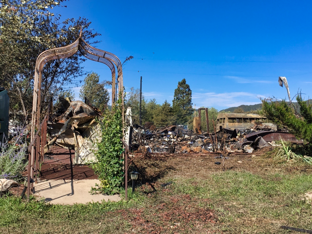
As of 9 a.m. Saturday, firefighters remain on scene extinguishing remaining flames and mopping up hot spots. The main structure has been confirmed as a complete loss. The number of additional structures lost in the fire is undetermined at this time.


The cause of the fire and cause of death of Bachmeier remains under investigation with more information expected to be released from the Meade County Sheriff's Office, South Dakota Fire Marshal's Office, South Dakota Division of Criminal Investigation and the Bureau of Alcohol, Tobacco, Firearms and Explosives.


The South Dakota Local Assistance State Team (LAST), has been requested to assist the Sturgis Fire Department with the aftermath of this tragedy.

Information from the Rapid City Fire Department


Sept. 7, 7:40 p.m.

One person was killed, one person was injured, and another person is missing after a propane explosion at a Tilford home Friday evening.

A firefighter's death was confirmed by Rapid City Fire Department Lt. Jim Bussell. He said the firefighter died from injuries sustained while fighting the fire. Specific information about the firefighter is not being released, as the family is in the process of being notified.

"This highlights the inherent dangers associated with fighting fire, and so I will just take the opportunity to ask everybody to offer their prayers and their support to firefighters," Bussell says.

A Meade County Sheriff's deputy was also injured by the fire. The deputy was taken to a local hospital with non-life-threatening injuries.

Bussell says a civilian is unaccounted for. Law enforcement and firefighters are searching for that person.

The fire is still active. So while tragedy strikes, those still at the fire must keep working.

"As you can imagine, that's a difficult proposition for the firefighters who are on scene," Bussell says.


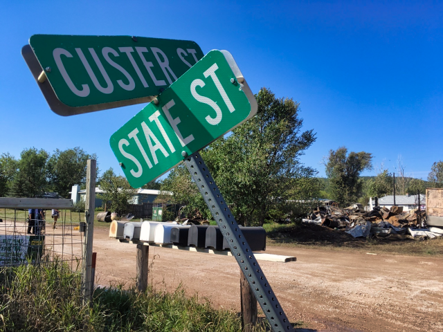
When the Sturgis Fire Department arrived to the home on State Street just before 5 p.m., they saw it was fully engulfed. Several outbuildings were also either on fire or threatened. And other propane tanks in the area were threatened as well.

The Sturgis Fire Department began attacking the fire, requesting mutual aid resources.

The home was destroyed, along with a number of outbuildings.

Firefighters are currently having difficulty with the fire due to downed power lines and the sheer amount of available fuel.

The cause of the fire is under investigation.

Agencies on scene include the South Dakota State Fire Marshal's Office, the Meade County Sheriff's Office, and the South Dakota Division of Criminal Investigation. ATF is en route.

Bussell wants it made clear - even though these agencies are involved, it shouldn't lead anyone to a conclusion as to the cause of the fire. These agencies are called anytime injuries and fatalities are associated with a fire.

In the video below, Bussell explains the situation.

__

5:50 p.m.

Multiple structures are threatened as flames engulf a structure on State Street in Tilford.

Firefighters and first responders began fighting the fire around 4:40 p.m. NewsCenter1 reporter Dominik Dausch said there was "popping sounds as power lines are damaged in the fire."

A propane tank exploded few minutes later, sending flames several feet into the air, as anyone driving near Exit 40 on Interstate 90 can see.

Watch video of the explosion below.

Additional information is not available at this time. NewsCenter1 will update this article as more details become available.

FLORENCE RAPIDLY STRENGTHENS INTO A MAJOR HURRICANE WITH A DIRECT HIT ON NORTH CAROLINA LATE THURSDAY. Florence is expected to produce total rainfall accumulations of 15 to 20 inches with isolated maxima to 30 inches near Florence's track over portions of North Carolina, Virginia, and northern South Carolina through Saturday


030 
WTNT31 KNHC 110904 CCA
TCPAT1

BULLETIN
Hurricane Florence Advisory Number  48...Corrected
NWS National Hurricane Center Miami FL       AL062018
500 AM AST Tue Sep 11 2018

Corrected time of next advisory

...HURRICANE AND STORM SURGE WATCHES ISSUED FOR PORTIONS OF THE
COASTS OF NORTH AND SOUTH CAROLINA...


SUMMARY OF 500 AM AST...0900 UTC...INFORMATION
----------------------------------------------
LOCATION...26.4N 64.1W
ABOUT 410 MI...660 KM S OF BERMUDA
ABOUT 975 MI...1570 KM ESE OF CAPE FEAR NORTH CAROLINA
MAXIMUM SUSTAINED WINDS...140 MPH...220 KM/H
PRESENT MOVEMENT...WNW OR 290 DEGREES AT 15 MPH...24 KM/H
MINIMUM CENTRAL PRESSURE...944 MB...27.88 INCHES


WATCHES AND WARNINGS
--------------------
CHANGES WITH THIS ADVISORY:

A Storm Surge Watch has been issued for the east coast of the
United States from Edisto Beach, South Carolina northward to
the North Carolina-Virginia border, including the Pamlico and
Albemarle Sounds.

A Hurricane Watch has been issued for the east coast of the United
States from Edisto Beach, South Carolina, northward to the
North Carolina-Virginia border, including the Pamlico and Albemarle
Sounds.

SUMMARY OF WATCHES AND WARNINGS IN EFFECT:

A Storm Surge Watch is in effect for...
* Edisto Beach South Carolina to the North Carolina-Virginia border
* Albemarle and Pamlico Sounds, including the Neuse and Pamlico
Rivers

A Hurricane Watch is in effect for...
* Edisto Beach South Carolina to the North Carolina-Virginia border
* Albemarle and Pamlico Sounds

Interests elsewhere in the southeastern and mid-Atlantic states
should monitor the progress of Florence.  Additional watches may be
required later today.

A Storm Surge Watch means there is a possibility of life-
threatening inundation, from rising water moving inland from the
coastline, in the indicated locations during the next 48 hours.
For a depiction of areas at risk, please see the National Weather
Service Storm Surge Watch/Warning Graphic, available at
hurricanes.gov.

A Hurricane Watch means that hurricane conditions are possible
within the watch area.  A watch is typically issued 48 hours
before the anticipated first occurrence of tropical-storm-force
winds, conditions that make outside preparations difficult or
dangerous.

For storm information specific to your area, including possible
inland watches and warnings, please monitor products issued by your
local National Weather Service forecast office.


DISCUSSION AND OUTLOOK
----------------------
At 500 AM AST (0900 UTC), the center of Hurricane Florence was
located near latitude 26.4 North, longitude 64.1 West.  Florence is
moving toward the west-northwest near 15 mph (24 km/h).  A west-
northwestward to northwestward motion with a slight increase in
forward speed are expected during the next couple of days.  On the
forecast track, the center of Florence will move over the
southwestern Atlantic Ocean between Bermuda and the Bahamas through
Wednesday, and approach the coast of North Carolina or South
Carolina on Thursday.

Maximum sustained winds are near 140 mph (220 km/h) with higher
gusts.  Florence is a category 4 hurricane on the Saffir-Simpson
Hurricane Wind Scale.  Some strengthening is expected during the
next day or so, and Florence is expected to be an extremely
dangerous major hurricane through Thursday night.

Hurricane-force winds extend outward up to 40 miles (65 km) from the
center and tropical-storm-force winds extend outward up to 150 miles
(240 km).

The estimated minimum central pressure is 944 mb (27.88 inches).


HAZARDS AFFECTING LAND
----------------------
STORM SURGE:  The combination of a dangerous storm surge and the
tide will cause normally dry areas near the coast to be flooded by
rising waters moving inland from the shoreline.  The water has the
potential to reach the following heights above ground if peak surge
occurs at the time of high tide...

Edisto Beach to Murrells Inlet...2-4 ft
Murrells Inlet to Cape Fear...4-6 ft
Cape Fear to Cape Lookout including The Neuse and Pamlico
River...6-12 ft
Cape Lookout to Ocracoke Inlet...5-8 ft
Ocracoke Inlet to North Carolina/Virginia Border...3-5 ft

The deepest water will occur along the immediate coast in areas of
onshore winds, where the surge will be accompanied by large and
destructive waves.  Surge-related flooding depends on the relative
timing of the surge and the tidal cycle, and can vary greatly over
short distances.  For information specific to your area, please see
products issued by your local National Weather Service forecast
office.

RAINFALL:  Florence is expected to produce total rainfall
accumulations of 15 to 20 inches with isolated maxima to 30 inches
near Florence's track over portions of North Carolina, Virginia, and
northern South Carolina through Saturday. This rainfall may produce
life-threatening flash flooding.

WIND:  Hurricane conditions are possible within the watch area by
late Thursday or Thursday night, with tropical storm conditions
possible by Thursday morning.

SURF:  Swells generated by Florence are affecting Bermuda and
portions of the U.S. East Coast.  These swells are likely to cause
life-threatening surf and rip current conditions.  Please consult
products from your local weather office.
 
============================================= 
 092 
WTNT31 KNHC 101448
TCPAT1

BULLETIN
Hurricane Florence Advisory Number  45
NWS National Hurricane Center Miami FL       AL062018
1100 AM AST Mon Sep 10 2018

...FLORENCE RAPIDLY STRENGTHENS INTO A MAJOR HURRICANE...


SUMMARY OF 1100 AM AST...1500 UTC...INFORMATION
-----------------------------------------------
LOCATION...25.0N 60.0W
ABOUT 580 MI...935 KM SSE OF BERMUDA
ABOUT 1240 MI...2000 KM ESE OF CAPE FEAR NORTH CAROLINA
MAXIMUM SUSTAINED WINDS...115 MPH...185 KM/H
PRESENT MOVEMENT...W OR 280 DEGREES AT 13 MPH...20 KM/H
MINIMUM CENTRAL PRESSURE...962 MB...28.41 INCHES


WATCHES AND WARNINGS
--------------------
There are no coastal watches or warnings in effect.

Interests in the southeastern and mid-Atlantic states should monitor
the progress of Florence. Storm Surge and Hurricane watches could
be issued for portions of these areas by Tuesday morning.


DISCUSSION AND OUTLOOK
----------------------
At 1100 AM AST (1500 UTC), the eye of Hurricane Florence was
located near latitude 25.0 North, longitude 60.0 West. Florence is
moving toward the west near 13 mph (20 km/h).  A west-northwestward
motion with an increase in forward speed is expected during the next
couple of days.  A turn toward the northwest is forecast to occur
late Wednesday night.  On the forecast track, the center of Florence
will move over the southwestern Atlantic Ocean between Bermuda and
the Bahamas Tuesday and Wednesday, and approach the coast of South
Carolina or North Carolina on Thursday.

Satellite data indicate that maximum sustained winds have increased
to near 115 mph (185 km/h) with higher gusts.  Florence is a
category 3 hurricane on the Saffir-Simpson Hurricane Wind Scale.
Further strengthening is anticipated, and Florence is expected to be
an extremely dangerous major hurricane through Thursday.

Hurricane-force winds extend outward up to 30 miles (45 km) from the
center and tropical-storm-force winds extend outward up to 140 miles
(220 km).

The estimated minimum central pressure is 962 mb (28.41 inches).


HAZARDS AFFECTING LAND
----------------------
SURF:  Swells generated by Florence are affecting Bermuda and
portions of the U.S. East Coast.  These swells are likely to cause
life-threatening surf and rip current conditions.  Please consult
products from your local weather office.


NEXT ADVISORY
-------------
Next complete advisory at 500 PM AST.
 
===================================================== 
 225 
WTNT31 KNHC 100853
TCPAT1

BULLETIN
Hurricane Florence Advisory Number  44
NWS National Hurricane Center Miami FL       AL062018
500 AM AST Mon Sep 10 2018

...FLORENCE RAPIDLY STRENGTHENING...
...EXPECTED TO BECOME A MAJOR HURRICANE VERY SOON...


SUMMARY OF 500 AM AST...0900 UTC...INFORMATION
----------------------------------------------
LOCATION...24.9N 58.9W
ABOUT 625 MI...1005 KM SE OF BERMUDA
ABOUT 535 MI...860 KM NNE OF THE NORTHERN LEEWARD ISLANDS
MAXIMUM SUSTAINED WINDS...105 MPH...165 KM/H
PRESENT MOVEMENT...WNW OR 285 DEGREES AT 9 MPH...15 KM/H
MINIMUM CENTRAL PRESSURE...969 MB...28.62 INCHES


WATCHES AND WARNINGS
--------------------
There are no coastal watches or warnings in effect.

Interests in the southeastern and mid-Atlantic states should monitor
the progress of Florence.


DISCUSSION AND OUTLOOK
----------------------
At 500 AM AST (0900 UTC), the center of Hurricane Florence was
located near latitude 24.9 North, longitude 58.9 West. Florence is
moving toward the west-northwest near 9 mph (15 km/h). A
west-northwestward motion with an increase in forward speed is
expected during the next couple of days.  A turn toward the
northwest is forecast to occur Wednesday night or Thursday. On the
forecast track, the center of Florence will move over the
southwestern Atlantic Ocean between Bermuda and the Bahamas Tuesday
and Wednesday, and approach the southeastern coast of the United
States on Thursday.

Satellite imagery indicates that the maximum sustained winds have
increased to near 105 mph (165 km/h) with higher gusts. Rapid
strengthening is forecast, and Florence is forecast to become a
major hurricane this morning, and is expected to remain an extremely
dangerous major hurricane through Thursday.

Hurricane-force winds extend outward up to 25 miles (35 km) from the
center and tropical-storm-force winds extend outward up to 125 miles
(205 km).

The estimated minimum central pressure is 969 mb (28.62 inches).


HAZARDS AFFECTING LAND
----------------------
SURF:  Swells generated by Florence are affecting Bermuda and
portions of the U.S. East Coast.  These swells are likely to cause
life-threatening surf and rip current conditions.  Please consult
products from your local weather office.


NEXT ADVISORY
-------------
Next complete advisory at 1100 AM AST.
================================================= 


431 
WTNT31 KNHC 091448
TCPAT1

BULLETIN
Hurricane Florence Advisory Number  41
NWS National Hurricane Center Miami FL       AL062018
1100 AM AST Sun Sep 09 2018

...FLORENCE FORECAST TO RAPIDLY INTENSIFY INTO A MAJOR HURRICANE BY
MONDAY...


SUMMARY OF 1100 AM AST...1500 UTC...INFORMATION
-----------------------------------------------
LOCATION...24.4N 56.3W
ABOUT 750 MI...1210 KM SE OF BERMUDA
ABOUT 610 MI...985 KM NE OF THE NORTHERN LEEWARD ISLANDS
MAXIMUM SUSTAINED WINDS...75 MPH...120 KM/H
PRESENT MOVEMENT...W OR 270 DEGREES AT 6 MPH...9 KM/H
MINIMUM CENTRAL PRESSURE...984 MB...29.06 INCHES


WATCHES AND WARNINGS
--------------------
There are no coastal watches or warnings in effect.


DISCUSSION AND OUTLOOK
----------------------
At 1100 AM AST (1500 UTC), the center of Hurricane Florence was
located by a NOAA Hurricane Hunter aircraft near latitude 24.4
North, longitude 56.3 West.  Florence is moving toward the west near
6 mph (9 km/h), and this general motion is expected to continue
today.  A west-northwestward motion with an increase in forward
speed is expected by Monday, and that motion is forecast to continue
through mid-week.  On the forecast track, the center of Florence
will move over the southwestern Atlantic Ocean between Bermuda and
the Bahamas Tuesday and Wednesday, and approach the southeastern
U.S. coast on Thursday.

Aircraft data indicate that maximum sustained winds have increased
to near 75 mph (120 km/h) with higher gusts.  Florence is forecast
to rapidly strengthen to a major hurricane by Monday, and is
expected to remain an extremely dangerous major hurricane through
Thursday.

Hurricane-force winds extend outward up to 15 miles (30 km) from the
center and tropical-storm-force winds extend outward up to 115 miles
(185 km).

The latest minimum central pressure reported by a NOAA Hurricane
Hunter Aircraft is 984 mb (29.06 inches).


HAZARDS AFFECTING LAND
----------------------
SURF:  Swells generated by Florence are affecting Bermuda and are
beginning to reach portions of the U.S. East Coast.  These swells
are likely to cause life-threatening surf and rip current
conditions.  Please consult products from your local weather office.
 
=============================== 

442 WTNT31 KNHC 090843 TCPAT1 BULLETIN Tropical Storm Florence Advisory Number 40 NWS National Hurricane Center Miami FL AL062018 500 AM AST Sun Sep 09 2018 ...FLORENCE EXPECTED TO BECOME A HURRICANE TODAY...


SUMMARY OF 500 AM AST...0900 UTC...INFORMATION
----------------------------------------------
LOCATION...24.5N 55.8W
ABOUT 765 MI...1235 KM SE OF BERMUDA
ABOUT 640 MI...1030 KM NE OF THE NORTHERN LEEWARD ISLANDS
MAXIMUM SUSTAINED WINDS...70 MPH...110 KM/H
PRESENT MOVEMENT...W OR 270 DEGREES AT 6 MPH...9 KM/H
MINIMUM CENTRAL PRESSURE...989 MB...29.21 INCHES


WATCHES AND WARNINGS
--------------------
There are no coastal watches or warnings in effect.


DISCUSSION AND OUTLOOK
----------------------
At 500 AM AST (0900 UTC), the center of Tropical Storm Florence was
located near latitude 24.5 North, longitude 55.8 West. Florence is
moving toward the west near 6 mph (9 km/h), and this general motion
is expected to continue today.  A west-northwestward motion with an
increase in forward speed is expected by Monday, and that motion is
forecast to continue through mid-week.  On the forecast track, the
center of Florence will move over the southwestern Atlantic Ocean
between Bermuda and the Bahamas Tuesday and Wednesday, and approach
the southeastern U.S. coast on Thursday.

Maximum sustained winds are near 70 mph (110 km/h) with higher
gusts.  Florence is expected to become a hurricane today and rapid
intensification is likely to begin by tonight.  Florence is forecast
to become a major hurricane on Monday.

Tropical-storm-force winds extend outward up to 125 miles (205 km)
from the center.

The estimated minimum central pressure is 989 mb (29.21 inches).


HAZARDS AFFECTING LAND
----------------------
SURF:  Swells generated by Florence are affecting Bermuda and are
beginning to reach portions of the U.S. East Coast.  These swells
are likely to cause life-threatening surf and rip current
conditions.  Please consult products from your local weather office.


NEXT ADVISORY
-------------
Next complete advisory at 1100 AM AST.
 
======================================= 
Tropical Storm Florence Discussion Number  35
NWS National Hurricane Center Miami FL       AL062018
1100 PM AST Fri Sep 07 2018

Florence remains a sheared tropical cyclone.  Satellite images
indicate that the low-level center is partially exposed on the
southwesterly edge of a large convective mass, with the overall
circulation somewhat elongated from southwest to northeast.
A blend of the latest Dvorak wind speed estimates from TAFB/SAB and
the CIMSS SATCON gives a value of 50 kt for this advisory.

While the winds at 200 mb are already from an easterly direction
near the center of Florence, there is significant shear from
northwesterly winds from 300-500 mb, undercutting the outflow layer.
This shear is forecast to relax by the global models over the next
36 hours as an anticyclone builds to the north of the storm, which
should promote some strengthening by Sunday. After 48 hours, the
deep-layer flow becomes easterly near the cyclone, with very little
shear while the system is over very warm waters.  This pattern
favors significant intensification, and most of the guidance brings
Florence back to a category 4 hurricane in 4 or 5 days.  The
intensity forecast is very similar to the last one, and is raised
slightly at days 3 and 4 to come into better agreement with the
guidance.  It is interesting to note that even with a lower initial
intensity, the guidance is higher than the last cycle, which speaks
to the strength of the signal for intensification in the long range.

The initial motion estimate is 265 degrees at 6 kt.  Florence is
expected to continue moving slowly westward for the next 48 hours
under the influence of a weak mid-level ridge over the western
Atlantic.  By days 4 and 5, an exceptionally strong blocking ridge
is forecast to develop between Bermuda and the Northeast U.S. and
build westward, keeping Florence on a west-northwestward trajectory
with a notable increase in forward speed by the end of the forecast
period.  It feels like a broken record to mention that the overall
guidance envelope keeps shifting southwestward, and the official
forecast is moved in that direction.  Unfortunately with such a
large well-defined steering current from the ridge becoming likely,
the extended-range risk to the United States keeps rising, which is
confirmed by the majority of the latest ensemble guidance.

Key Messages:

1. Regardless of Florence's eventual track, large swells are
affecting Bermuda and will begin to affect portions of the U.S.
East Coast this weekend, resulting in life-threatening surf and rip
currents.

2. The risk of other direct impacts associated with Florence along
the U.S. East Coast next week has increased.  However, there is
still very large uncertainty in model forecasts of Florence's track
beyond day 5, making it too soon to determine the exact location,
magnitude, and timing of these impacts.  Interests near and along
the U.S. East Coast should monitor the progress of Florence through
the weekend and ensure they have their hurricane plans in place.

If you have a generator or plan to buy one to use during the storm, there are safety measures you should observe.


Hurricane Florence has North Carolinians hoping for the best but preparing for the worst.
If you have a generator or plan to buy one to use during the storm, there are safety measures you should observe.

  • Use generators outside of the home in well-ventilated areas
  • Keep them at least five feet from all doors, windows, and vent openings
  • Never use a generator in a garage, even with the door open
  • Make sure the exhaust is directed away from your home an install carbon monoxide alarms
  • Never refuel a generator when it is hot
  • Store fuel outside
  • If you are using a generator to power your entire home, make sure an electrician installs it properly
=========================================


Using Generators

If you own a generator and have it wired into your house, you must have a transfer switch to prevent electricity from feeding back on your service line and possibly injuring Jefferson employees who are trying to restore your power.


Portable Generators - Use Them Safely!
We recognize the worth of portable electric generators but they need to be used wisely. Portable electric generators can be hazardous if used improperly. Some of the hazards are:


  • carbon monoxide poisoning from the engine exhaust 
  • electrocution from improper connections of the generator into the electrical wiring system.

Remember to always follow the direction provided by the manufacturer as well as your local electrical inspection agency and a licensed electrician. Never operate these devices except as intended by the manufacturer. Follow these general precautions to protect against carbon monoxide poisoning:

  • Never use a generator indoors or in attached garages. Proper ventilation is essential. 
  • Only operate the generator outdoors in a well-ventilated, dry area, and keep the exhaust away from air intakes to the home, and keep the unit protected from direct exposure to rain and snow, preferably under a canopy, open shed or carport. 

Follow these precautions to avoid electrical accidents:

  • Plug individual appliances into the generator using heavy duty, outdoor-rated cords with a wire gauge adequate for the appliance load. 
  • Observe the generator manufacturer's instructions for safe operation. 
  • Do not plug the generator into a wall outlet. 
  • If it is necessary to connect the generator to the house wiring, always use a qualified electrician to properly install the standby electrical generator system.

If temporary connection into the house wiring is necessary to operate permanently wired equipment, such as water pump, furnace blower/controls, room lighting, etc., there are important steps that require the utmost care to avoid electrocution.

  • Have a qualified electrician install a manual transfer switch. A transfer switch, normally supplied by the electrician, permits transfer of the load from the household power source over to the portable generator. The transfer switch should be certified by UL or other independent test lab for this application, and be mounted within an electrical enclosure. Transfer switches and related accessories designed for connecting a standby system are available from electrical supply stores. 
  • When properly installed, the transfer switch will isolate the circuits supplied by the generator from those normally supplied by the utility. This prevents inadvertently energizing circuits in both systems, and reduces the possibility of electrocution resulting from contact with conductors presumed to be de-energized. 
  • Do not operate more appliances and equipment than the output rating of the generator. 
  • And remember! do not store gasoline in the home. Gasoline, kerosene and other flammable liquids should be stored outside of living areas in properly labeled, non-glass safety containers. They should not be stored in a garage that has a fuel-burning appliance. The vapor from gasoline can travel invisibly along the ground and be ignited by pilot lights or arcs caused by activating electric switches.

Portable generators - What would we do without them during extreme power outages? An equally important question is: Do you know what to do with them? Follow the safety precautions and Be Safe!