

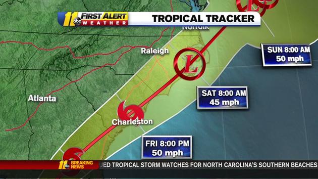
Tropical Storm Hermine's path
Updated 8 mins ago
Hermine has been upgraded to a category 1 hurricane. The storm is expected to weaken as it passes over Florida but will still be a big weather maker for North Carolina.
Wind gusts from Hermine could be between 20 to 30 mph in the central part of our state, ABC11 Meteorologist Don "Big Weather" Schwenneker said.
The National Weather Service has issued tropical storm watches and warnings for our southern beaches and a flash flood watch for Robeson and Bladen counties Friday through Saturday morning.
A state of emergency has been declared for most of Florida as Hurricane Hermine moves through the Gulf of Mexico. Two counties issued mandatory evacuation orders for several coastal towns. Hermine is expected to make landfall late Thursday or early Friday.
Hermine will be the first hurricane to strike Florida in 11 years, which smashes the old record of a four-year span between hurricanes.
Schwenneker says as Hermine approaches our state, a breeze will pick up Friday, but the strongest winds (which could reach 45 mph at times) will be Friday night into Saturday.
The center of Hermine is expected to track west of the Carolina coast Friday and Friday night. This will bring an enormous amount of moisture into our region leading to rain heavy at times on Friday, Friday night, and Saturday morning.
"This heavy rainfall will lead to flooding in spots, and this could cause road closures," Schwenneker said. "People living in flood-prone areas will need to review evacuation procedures."
Hermine will move away from the region on Saturday and the rain will taper off and end Saturday afternoon. It still will stay breezy through Saturday night.
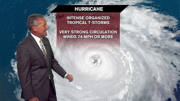
Chief Meteorologist Chris Hohmann explains how a hurricane forms.
Dry, stable air will flow into the region on Sunday, and this dry flow of air should help bring nice weather for the rest of the Labor Day weekend through the middle of next week.