MEC&F Expert Engineers

Sunday, September 13, 2015

The Earth’s remaining fossil fuel resources would be sufficient to melt nearly all of Antarctica if burned


What Will it Take to Melt Antarctica's Ice?


By MarEx 2015-09-12 21:01:59

New work from an international team including Carnegie Institution for Science’s Ken Caldeira demonstrates that the Earth’s remaining fossil fuel resources would be sufficient to melt nearly all of Antarctica if burned, leading to a 50- or 60-meter (160- to 200-foot) rise in sea level.

Because so many major cities are at or near sea level, this would put many highly populated areas where more than a billion people live under water, including New York City and Washington, DC, sates the report published in Science Advances.

“Our findings show that if we do not want to melt Antarctica, we can’t keep taking fossil fuel carbon out of the ground and just dumping it into the atmosphere as CO2 like we’ve been doing,” Caldeira said. “Most previous studies of Antarctic have focused on loss of the West Antarctic Ice Sheet. Our study demonstrates that burning coal, oil and gas also risks loss of the much larger East Antarctic Ice Sheet.”

Caldeira initiated the project with lead author Ricarda Winkelmann while she was a Visiting Investigator at the Carnegie Institution for Science. Winkelmann and co-author Anders Levermann are at the Postdam Institute for Climate Impact Research; co-author Andy Ridgwell is at the University of California Riverside.

Although Antarctica has already begun to lose ice, a complex array of factors will determine the ice sheet’s future, including greenhouse gas-caused atmospheric warming, additional oceanic warming perpetuated by the atmospheric warming and the possible counteracting effects of additional snowfall.

“It is much easier to predict that an ice cube in a warming room is going to melt eventually than it is to say precisely how quickly it will vanish,” Winkelmann said, explaining all the contributing factors for which the team’s models had to account.

The team used modeling to study the ice sheet’s evolution over the next 10,000 years, because carbon persists in the atmosphere millennia after it is released. They found that the West Antarctic ice sheet becomes unstable if carbon emissions continue at current levels for 60 to 80 years, representing only six to eight percent of the 10,000 billion tons of carbon that could be released if we use all accessible fossil fuels.

“The West Antarctic ice sheet may already have tipped into a state of unstoppable ice loss, whether as a result of human activity or not. But if we want to pass on cities like Tokyo, Hong Kong, Shanghai, Calcutta, Hamburg and New York as our future heritage, we need to avoid a tipping in East Antarctica,” Levermann said.

The team found that if global warming did not exceed the two degree Celsius target often cited by climate policymakers, Antarctic melting would cause sea levels to rise only a few meters and remain manageable. But greater warming could reshape the East and West ice sheets irreparably, with every additional tenth of a degree increasing the risk of total and irreversible Antarctic ice loss.

This is the first study to model the effects of unrestrained fossil-fuel burning on the entirety of the Antarctic ice sheet. The study does not predict greatly increased rates of ice loss for this century, but found that average rates of sea level rise over the next 1,000 years could be about three centimeters per year (more than one inch per year) leading to about 30 meters (100 feet) of sea level rise by the end of this millennium. Over several thousand years, total sea level rise from all sources could reach up to 60 meters (200 feet).

"If we don't stop dumping our waste CO2 into the sky, land that is now home to more than a billion people will one day be underwater," Caldeira said.



This chart shows how Antarctic ice would be affected by different emissions scenarios. (GtC stands for gigatons of carbon.) It is provided courtesy of Ken Caldeira and Ricarda Winkelmann.

Containership MV Cape Moreton caught fire while berthed at the Manila International Container Terminal


Containership Catches Fire at Port of Manila – INCIDENT PHOTOS

September 12, 2015 by Mike Schuler


Photo credit: REUTERS/Romeo Ranoco


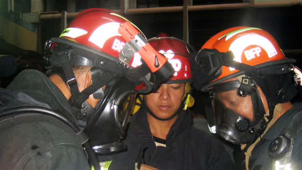
The Marshall Islands-flagged containership MV Cape Moreton caught fire while berthed at the Manila International Container Terminal (MICT) in the Philippines. Photos from the scene show thick smoke billowing from the cargo area as firefighters battled the blaze.

The cause of the fire is under investigation. Typically, these container boxes may contain flammable chemicals or material that catch fire if there is a sparking event.


Photo credit: REUTERS/Romeo Ranoco

Photo credit: REUTERS/Romeo Ranoco

Photo credit: REUTERS/Romeo Ranoco

Photo credit: REUTERS/Romeo Ranoco


//---------------------------///


Container Ship Fire, Responders Asked for ID
 

file photo, credit Manila Fire Department

By MarEx 2015-09-12 20:25:45

A container ship caught fire at the Manila International Container Terminal in The Philippines on Saturday.

The Philippine Coast Guard and local authorities responded with tugs and fire trucks to assist the crew’s fire-fighting efforts.

However, according to local media reports, it took almost nine hours to contain the fire on the 220m Cape Moreton partly because responders were unfamiliar with the ship and partly because were asked by the crew to show ID before boarding the vessel.

Media reports indicate that there may have been an explosion inside containers carrying sodium hydroxide that sent flames and smoke billowing up from the cargo area.

The extent of the damage to the vessel is unknown at this stage.

Cape Moreton has a Russian crew, is owned by Cape Moreton Shipping and is operated by Hanse Bereederung GmbH.

1 teen driver killed, 3 injured after his pickup hit a drainage ditch, flipped over, and then struck a utility pole and a mail box in Bucks County, PA


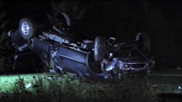
A 17-year-old driver was killed and three others were injured in a crash in Bucks County.

The accident occurred around 1:00 a.m. Sunday on Limekiln Pike in New Britain Township.

Police say the 17-year-old was driving a pickup truck went he went off the road.

The pickup hit a drainage ditch, flipped over, and then struck a utility pole and a mail box.

The driver was pronounced dead at the hospital.

The three survivors were taken to Lehigh Valley Hospital for treatment. One is listed in critical condition.

Police tell Action News open beer cans were found inside the truck, but say it's too soon to tell if alcohol was a factor. 


Of course alcohol, speed, inattention are the main causes of these crashes.

Rough Fire in Fresno County, California grows to more than 128,000 acres, becomes 17th largest in California history


Rough Fire
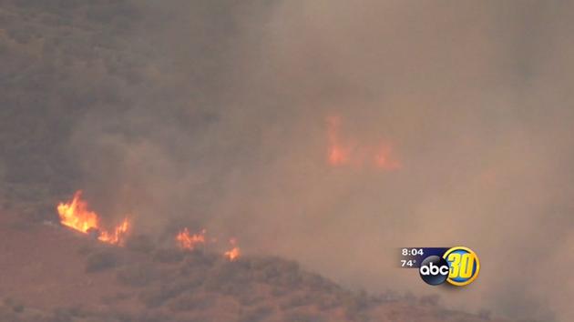
The Rough Fire burning in Fresno County continues to grow. The wildfire has scorched more than 128,000 acres, making it the 17th largest fire in California's history. Containment is estimated at 29 percent.

On Saturday, the Fresno County Sheriff's Office issued evacuation warnings for the area along Hopewell Road north of Highway 180 and east to the Sequoia National Forest boundary. The blaze has also forced dozens of families in Dunlap from their homes.


Smoke from the fire continues to blanket the Valley, prompting health officials to extend an air quality alert through Sunday.

Rough Fire Information


Size: 128,796 Acres

Containment: 29 percent

Total Personnel: 2,961

Mapping adjustments resulted in an increase in the total acreage to 128,796 acres and is currently the largest active fire in California. There are 2,961 personnel currently assigned to the Rough Fire. Containment remains 29%. Rough Fire Information: (559) 332-2028, (559) 549-4837 or (559) 842-6248.

Air Quality Today: Heavy concentrations of smoke are expected near the fire and to the west foothills today. Smoke will be slow to lift and transport will be primarily terrain and diurnally driven. Limited ventilation is forecast for today with continued increased impacts expected in the San Joaquin Valley west and northwest of fire. Unhealthy to Hazardous conditions are expected in the foothill communities west and northwest of the fire. Conditions improve in the Owens Valley.

Air Quality Tomorrow: A more south to southwest wind will begin to alleviate smoke impacts in the San Joaquin Valley. More smoke will impact the northern portion of the Owens Valley.

Click here to view Daily Air Quality Forecast

MANDATORY EVACUATION ORDERS


The Fresno County Sheriff's Office and fire officials would like to clarify the guidelines of the current evacuation situation.

Residents who have a Dunlap, Miramonte, or Pinehurst zip code must understand they are considered to be in either a mandatory evacuation area or an evacuation warning area.

Mandatory Evacuation Areas
- All properties on the north and south sides of Highway 180 east of the Highway 180/Dunlap Road junction.
- All properties adjacent to the north side of Dunlap Road from the Highway 180/Dunlap Road junction to the Dunlap Road/Millwood Road Junction.
- All properties on both sides of Millwood Road.
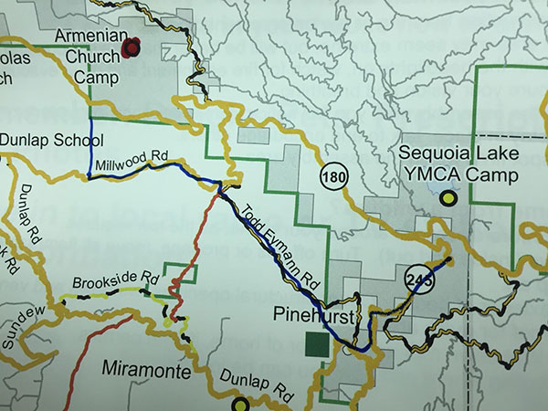
- All properties on both sides of Todd Eymann Road from Millwood Road to Highway 245.
- All properties on both sides of Highway 245 from Todd Eymann Road to Highway 180.

Evacuation Warning Areas
- All properties on the south side of Dunlap Road from the Highway 180/Dunlap Road junction east to the Dunlap Road/Millwood Road junction
- All properties on both sides of Dunlap Road from the Dunlap Road/Millwood Road junction east to the Dunlap Road/Highway 245 junction.
- All properties on both sides of Brookside Road. Evacuation Areas Impacted by Rough Fire

Definitions of Fire Terms
An evacuation warning is defined as an alert to community members in an area of a potential threat to life and property from an emergency incident. An evacuation warning may be issued when the potential or actual threat to civilian life is more than 2 hours away. When a warning is issued, residents are being warned to prepare to leave their home. The Sheriff's Office tries to issue the advisory as early as possible based upon the fire's activity so residents will have time to remove their pets, livestock, large boats, RV's and any other personal effects in an orderly, unrushed manner. However, because a wildfire can be unpredictable, the time frame between an advisory and a mandatory evacuation can change quickly. You must be prepared to go at any time.

A mandatory evacuation is declared when a wildfire directly threatens a community and residents are placed in danger. You must leave the area for you and your family's safety. Once you leave, you will not be allowed to return to your property until the mandatory evacuation is lifted.

EVACUATION CENTER
Sanger Community Center - 730 Recreation Ave. Sanger, CA

Evacuation Map - Evacuations are along the blue line. Authorities are starting at Millwood Road and moving east.
The Central CA Animal Disaster Team Activates Emergency Animal Shelter in Sanger, CA For Household Pets Affected By Rough Fire

The Central California Animal Disaster Team has been deployed by the Fresno County Office Of Emergency Services to assist with displaced small and large animals due to the Rough Fire.

Small animal evacuation shelter will be open for pets of families under mandatory evacuation orders: CCADT has activated an emergency animal shelter for household pets at the same location where Red Cross has activated a human shelter - Sanger Community Center - 730 Recreation Ave. Sanger, CA. The shelter will be open on Friday, September 11th for residents under MANDATORY evacuation orders.

Large animal assistance. CCADT is coordinating efforts with the Fresno County Sheriff's Office to evacuate large animals. If you need assistance with evacuation and sheltering for large animals (livestock, horses, etc.), please contact the Central CA Animal Disaster Team at 559-433-WOOF (9663).

Updates on changes available on the CCADT.ORG website or our Facebook page: https://www.facebook.com/CCADT1

Donations are needed: General monetary donations are GREATLY needed at this point. In kind donations cannot be taken because the shelter needs to remain mobile. To donate please visit: http://www.ccadt.org/donate.html

Please work with emergency responders and follow all guidelines. It is important to follow the evacuation guidelines with your pets. Safety is the number one priority for everyone. Please visit our website for help with evacuating with your pet and for items that should be kept in your pet's go bag.

Rough Fire Progression Map

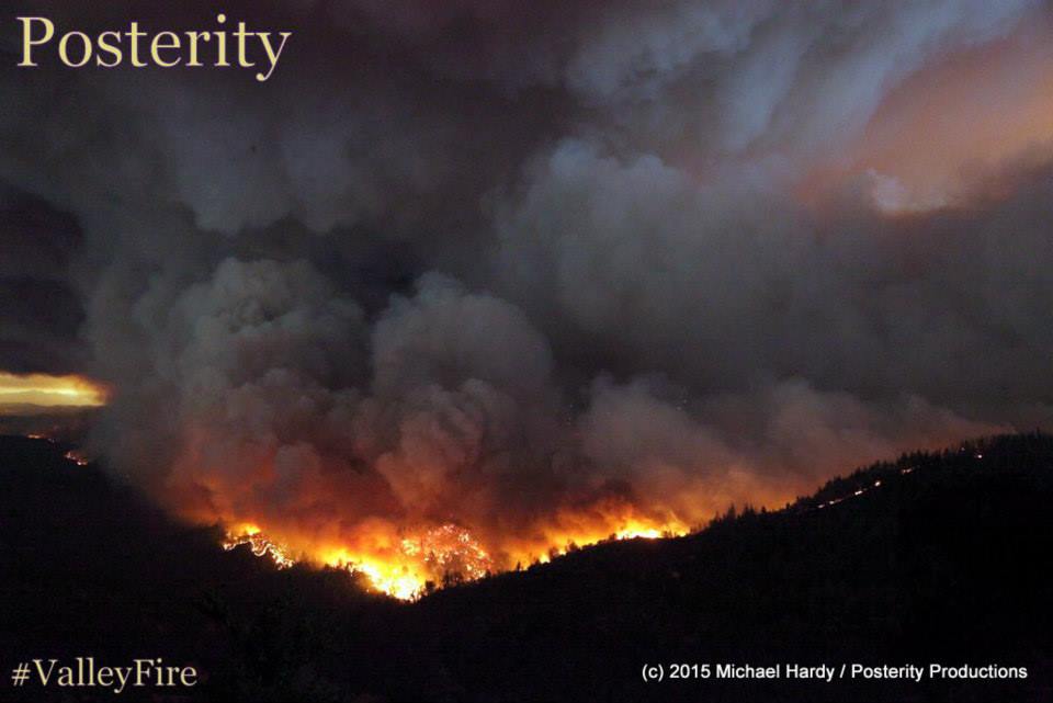
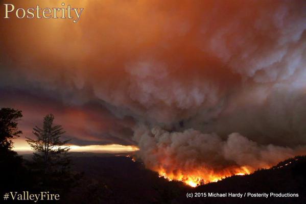
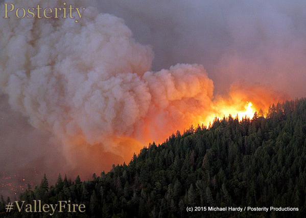
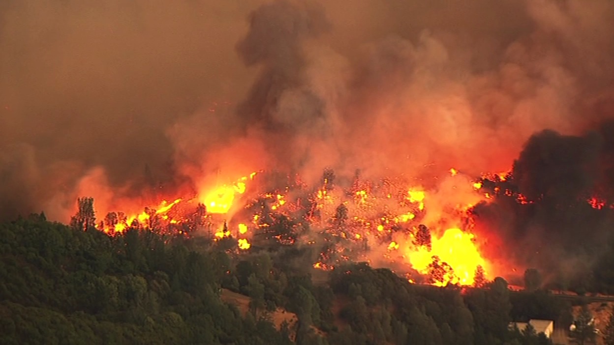
More than 3,000 flee Lake County, California as Valley Fire spreads to 25,000 acres


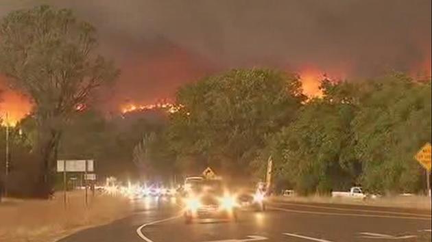
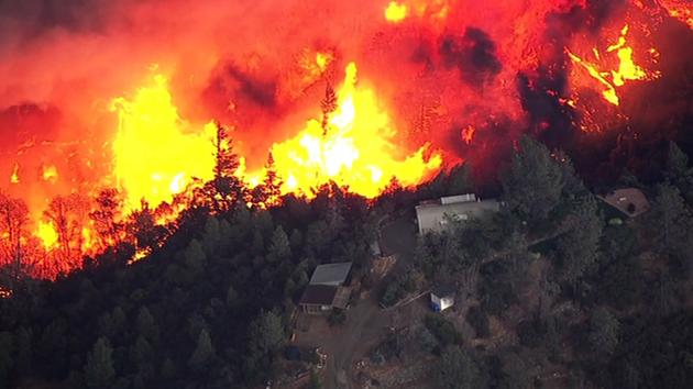
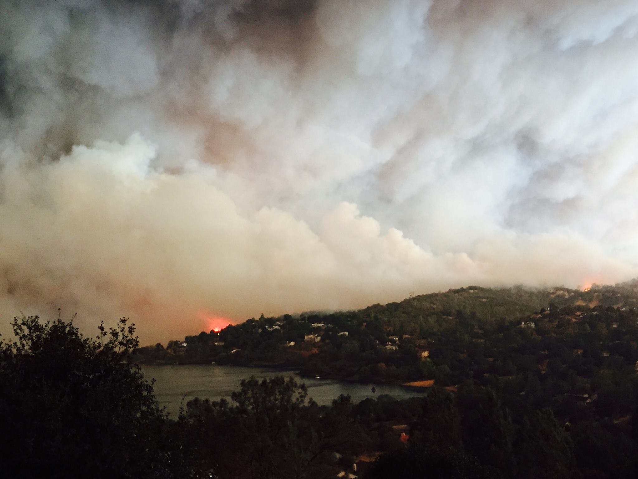
Cal Fire says the Valley Fire in Lake County has grown to over 25,000 acres burning homes, shutting down parts of Highway 29 and forcing the evacuation of thousands of people from of nearby towns.


By Katie Utehs
Saturday, September 12, 2015 11:55PM

LAKE COUNTY, Calif. -- Cal Fire says the Valley Fire in Lake County has grown to over 25,000 acres burning homes, shutting down parts of Highway 29 and forcing the evacuation of nearby towns and more than 3,000 people.

The California Department of Forestry and Fire Protection says the fire began around 1:30 p.m. Saturday in Lake County, which is about 100 miles north of San Francisco. At its start, it was 50 acres, but grew to 400 by 4 p.m. It was over 10,000 acres by 6:30 p.m. It was past 25,000 acres late Saturday night.


The Valley Fire in Lake County, Calif., burned thousands of acres on Saturday, September, 12, 2015. KGO-TV

"Everything I've heard so far is everything behind the gas station is gone, the school is gone, the store is gone and a lot of people had dogs stuck up there," said Cobb resident Jamie Kelley.

"As we came down just fire everywhere and all of our houses our neighbor's houses, our friend's houses. Everybody's houses are burning up its awful," Joyce Reim, who also lives in Cobb.

Cal Fire says an unknown number of homes have been destroyed. There are also reports that Middletown Christian School was destroyed in the fire.


The Lake County Sheriff's Office and Cal Fire have issued a mandatory evacuation order for the following communities:


Bottle Rock Road, High Valley Road, Hwy 175 Cobb, Hwy 29 Tubbs Lane (Calistoga, Napa County) to Hwy 29/Hwy 53 (Lower Lake, Lake County) Butts Canyon Road to Napa County Line, including Berreyssa Estates. The evacuation orders also includes the communities of Cobb, Seigler Canyon, Loch Lomond, Middletown and Hidden Valley Lakes.

Several road have also been closed in Lake County: Highway 29 at Bottle Rock Road, Highway 29 at Highway 175 (Kelseyville and Middletown), Highway 29 at Red Hills Road and Highway 29 at Loch Lomond. Highway 29 is also closed from Spruce Grove Road North in Lower Lake to Butts Canyon Road in Middletown.


Residents have been advised to gather their medications, pets, and important papers and leave the area immediately. If residents are evacuated they may seek shelter at the, Kelseyville Presbyterian Church, which is located at 5340 Church Street in Kelseyville.

An evacuation center has been set up for residents on the south side of the Valley Fire at the Napa County Fairgrounds in Calistoga.

"It looked like a sideways tornado the smoke was rolling across the planes," said Lacy Port from Lake Port, who had to escape.

"The pastures and cows and stuff were on fire. Their family owns a trucking company that has lots of chemicals on Socrates Mine road so that's not going to be good if the fire hits that," said Marla Ivans of Clearlake,

Cell service is spotty, which added to the tension as people desperately wait for news from loved ones.

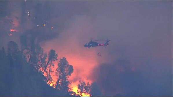
More than 100 firefighters from Cal Fire and the South Lake County Fire Protection District are on the scene. Aerial resources are aggressively fighting the High Valley Incident that is burning at a moderate of spread in oak grass woodland.

Cal Fire PIO Daniel Berlant told ABC7 News that the dry conditions due to the drought are why these California wildfires are spreading so fast. He also said the extent of the injuries to the firefighter is not yet known.

Cal Fire said four firefighters suffered second-degree burn injuries and were transported to the burn center at U.C. Davis Medical Center. All are in stable condition. They were members of a helicopter crew based in Lake County.

President of CAL FIRE Local 2881, tweeted that he visited the for injured firefighters and said they are all expected to make full recovery.