Our area could be in Hurricane Joaquin's path
AccuWeather is tracking Hurricane Joaquin.

Updated 1 hr 1 min ago
PHILADELPHIA (WPVI) -- Hurricane Joaquin formed near the Bahamas on Wednesday morning, and we're keeping a close eye on the storm as it moves north.
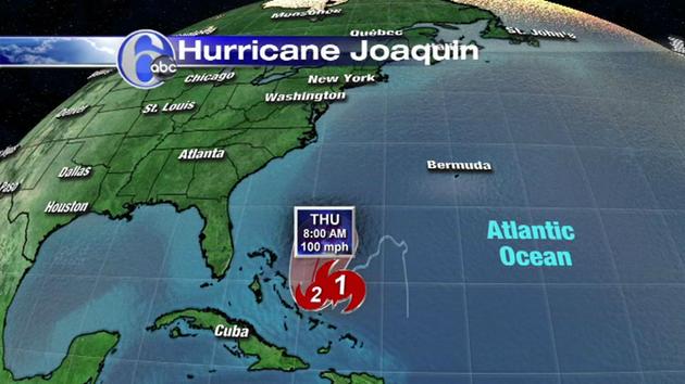
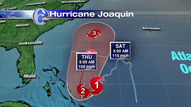
The U.S. National Hurricane Center long-term forecast showed the storm could near the East Coast somewhere above North Carolina early next week, but it said the complexity of the weather environment means "it is too soon to say what impacts, if any, Joaquin will have on the United States."
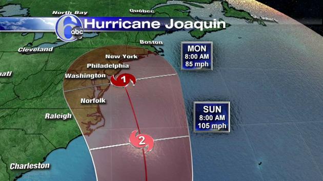
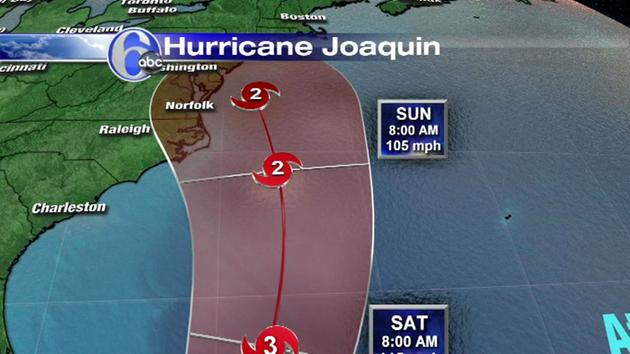
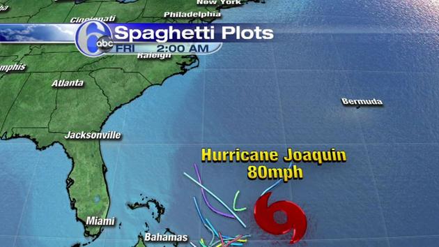
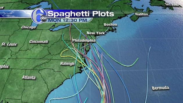
Models show the 6abc viewing area inside the 'cone of uncertainty.' While that cone only encompasses possible tracks, people inside the cone should keep a close eye on the storm and be prepared.
"We've got Air Force reconnaissance planes continuously giving us data from inside the hurricane this morning, and we're going to be throwing a lot more aircraft resources at this problem over the next few days because it still is not certain whether or not Joaquin will directly impact the U.S. East Coast or stay out to sea," said Rick Knabb, director of the National Hurricane Center.
Our AccuWeather team says confidence in the track of the storm remain low and a wide range of outcomes is possible, from a direct impact of a major hurricane along the U.S. East Coast to a track sending Joaquin out to sea.
AccuWeather is tracking Hurricane Joaquin.
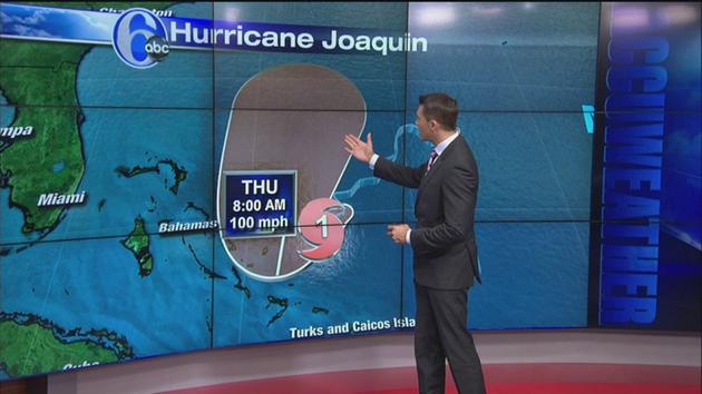
A hurricane warning has been issued for the central Bahamas as the storm approaches.
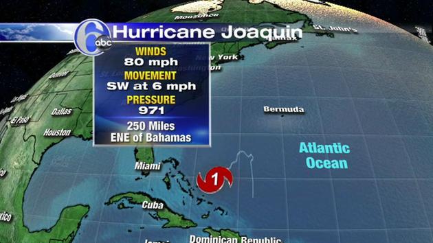
Maximum sustained winds reached 85 mph (135 kph) and extended 35 miles (55 kilometers) from the center of the storm over the Atlantic Ocean, according to the U.S. National Hurricane Center in Miami, which predicted Joaquin would develop into a major hurricane in the coming days.
The center of the storm Wednesday afternoon was about 175 miles (285 kilometers) east-northeast of the central Bahamas and moving toward the southwest at 8 mph (13 kph).
Stay with Action News, 6abc.com and AccuWeather for the very latest storm track.