MEC&F Expert Engineers

Friday, July 10, 2015

1 killed and several injured on I-94 near Mattawan, Michigan after a semi-truck rear-ended a Chicago couple's Cadillac.

EB I-94 open again after fatal multi-vehicle crash

VAN BUREN COUNTY, Mich. (WZZM) -- 

Eastbound I-94 has opened again after being closed near Mattawan for a multi-vehicle accident.

Michigan State Police said the crash was reported around 1:30 p.m. Friday near exit 66.  An eastbound semi-truck driven by a 51-year-old Nevada man rear-ended a Chicago couple's black Cadillac. The Cadillac was pushed into a red Pontiac Grand Am driven by a 51-year-old Paw Paw woman. The semi then veered into the right lane and rear-ended another semi driven by a 38-year-old Coopersville man.

The driver of the Cadillac was pronounced dead at Bronson Lakeview Hospital in Paw Paw, and the passenger is in serious condition. The at-fault semi driver is also in serious condition.

At the time of the crash, traffic on that stretch of freeway had been slowed or stopped by a grass fire in the median east of the scene. Investigators said drivers need to stay alert as traffic conditions change.

Shortly after 3:30 p.m., MDOT tweeted that all lanes of eastbound I-94 had opened again.

San Antonio police officer killed, his 2 children seriously injured in head-on crash in north Bexar County, Texas


By Mark D. Wilson : July 10, 2015


  • Photo By Bexar County Sheriff's Office 
    Emergency crews work the scene of a fatal crash on the far North Side of San Antonio near Borgfield Drive and Bulverde Road on July 10, 2015.
SAN ANTONIO, TEXAS


An off-duty San Antonio Police Department officer died and two children were hospitalized Friday following a head-on collision in north Bexar County.

Bexar County Sheriff's Office spokesman James Keith said the officer, identified by SAPD as 41-year-old Paul Rios, had been headed east in an SUV carrying his two children on Borgfeld Drive near Bulverde Road when he collided with a Ford F-250 pickup heading west around 11:30 a.m.

Rios, who was off duty but in uniform at the time of the crash, was pronounced dead at the scene while the two children were flown to University Hospital with injuries described as serious but not life-threatening, Keith said.

“It’s too early to determine the specifics of how this accident happened,” he said. “That’s something that we will investigate."

The driver of the pickup, who was not named, was transported to North Central Baptist Hospital in stable condition.

Major Flooding in Ozark, Missouri. Food warning for Greene and Christian Counties

Aerial photos: Flooding in Ozark


This morning, most of the Ozarks woke up to 1 to 3 inches of rain, which cause flash flooding in places and contributed to other flooding.

According to Andy Foster of the National Weather Service, the heaviest rain was along the Highway 60 corridor. That has led to a flood warning for Greene and Christian, as well as Jasper, Barry, McDonald, Newton, Stone and Lawrence counties.

But, while those places are still experiencing flooding, Foster says the rain should be ceasing. He said the Ozarks should catch a break later today and into the weekend, with temperatures are expected to reach 87 today, then 90, 91 and 92 over the next three days.

Foster said there were multiple water rescues at low-water crossings and trailer parks. We will have more information on those throughout the day.

Officials warn not to drive over roadways that are covered by water. It only takes a few inches of swiftly flowing waster to carry vehicles away.

FLASH FLOOD WARNING: Water evacuations occurring in Clay County, West Virginia


Posted: July 10, 2015
2 miles ESE of Amma [Roane Co, WV] 911 call center reports FLASH FLOOD at 12:00 PM EDT -- extensive road flooding in the southern part of Roane County...particularly along and south of I-79.|

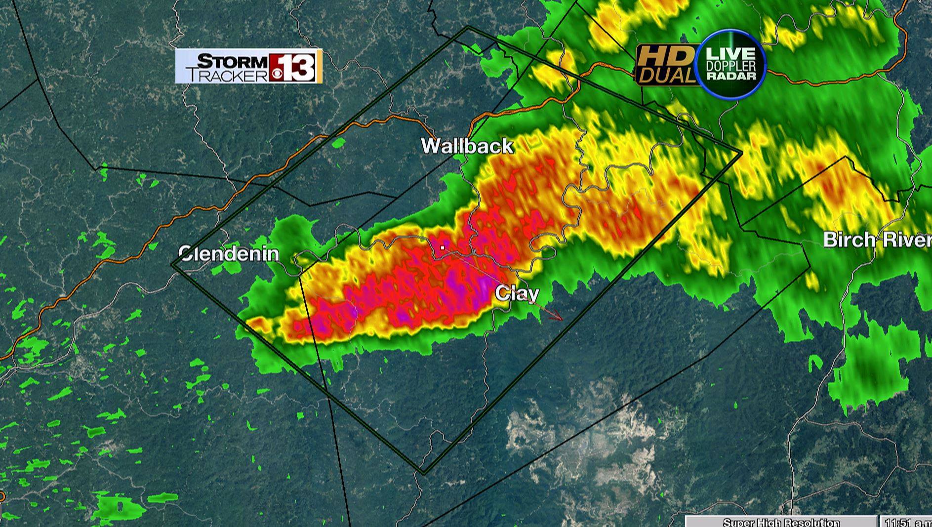
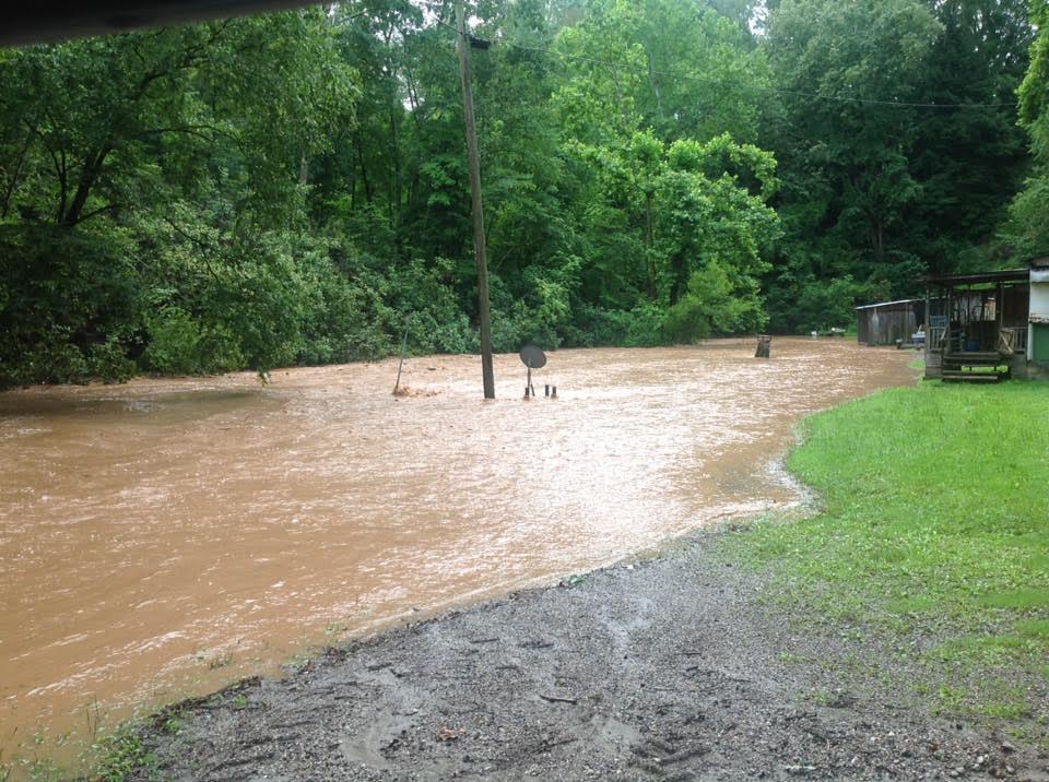
Wallback [Clay Co, WV] 911 call center reports FLASH FLOOD at 12:23 PM EDT -- flooding reported in town of Wallback with water rescues and evacuations currently ongoing via Clay County 911... Cookman Fork out of its banks and into homes.

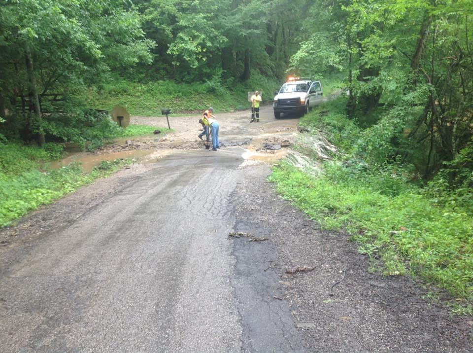
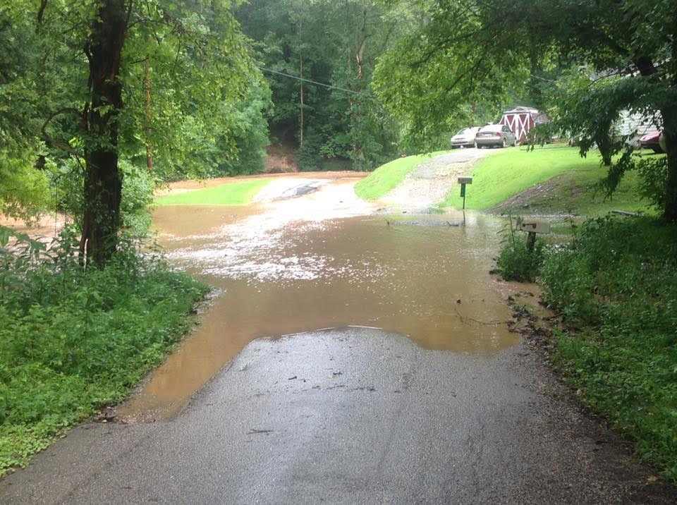
3 miles S of Wallback [Clay Co, WV] 911 call center reports FLASH FLOOD at 12:00 PM EDT -- Clay County 911 reports road closures on Wallback road from flooding in the Valley Fork area from Valley Fork Creek.

A * FLASH FLOOD WARNING FOR...
ROANE COUNTY IN WEST VIRGINIA...
CALHOUN COUNTY IN WEST VIRGINIA...
CLAY COUNTY IN WEST VIRGINIA...
BRAXTON COUNTY IN WEST VIRGINIA...
NORTHEASTERN KANAWHA COUNTY IN WEST VIRGINIA...

* UNTIL 245 PM EDT *

AT 1147 AM EDT...DOPPLER RADAR INDICATED HEAVY RAIN ACROSS THE WARNED AREA. UP TO TWO INCHES OF RAIN HAVE ALREADY FALLEN. FLASH FLOODING IS EXPECTED TO BEGIN SHORTLY.

* SOME LOCATIONS THAT WILL EXPERIENCE FLOODING INCLUDE... CLAY...CLENDENIN...GLEN...WALLBACK...BIG OTTER...HARRISON... IVYDALE...BICKMORE...INDORE...STRANGE CREEK AND PROCIOUS.
PRECAUTIONARY/PREPAREDNESS ACTIONS...
MOVE TO HIGHER GROUND NOW.
ACT QUICKLY TO PROTECT YOUR LIFE.

PLEASE REPORT HIGH WATER TO THE NATIONAL WEATHER SERVICE BY CALLING TOLL FREE...800 401 9535...WHEN YOU CAN DO SO SAFELY.


* FLASH FLOOD WARNING FOR...
NICHOLAS COUNTY IN WEST VIRGINIA...
CENTRAL CLAY COUNTY IN WEST VIRGINIA...
NORTHEASTERN FAYETTE COUNTY IN WEST VIRGINIA...
SOUTHWESTERN BRAXTON COUNTY IN WEST VIRGINIA...
SOUTHWESTERN WEBSTER COUNTY IN WEST VIRGINIA...

* UNTIL 345 PM EDT *

AT 1249 PM EDT...DOPPLER RADAR INDICATED HEAVY RAIN HAD BEEN FALLING ACROSS THE WARNED AREA FROM THUNDERSTORMS. UP TO ONE INCH OF RAIN HAS ALREADY FALLEN. ADDITIONAL STORMS WERE MOVING INTO THE AREA AND ANOTHER INCH OF RAIN IS POSSIBLE. FLASH FLOODING IS EXPECTED TO BEGIN SHORTLY.

* SOME LOCATIONS THAT WILL EXPERIENCE FLOODING INCLUDE... SUMMERSVILLE...CAMDEN-ON-GAULEY...CRAIGSVILLE...BIRCH RIVER... CAMDEN ON GAULEY...COWEN...NETTIE...KESSLERS CROSS LANES... CALVIN...BENTREE...MOUNT NEBO...DRENNAN...WIDEN...SWISS...CANVAS... MUDDLETY AND UPPER GLADE.

Manasquan, a New Jersey shore town, won't rebuild its Sandy Superstorm-wrecked sand dunes


MANASQUAN, N.J. (AP) — 

Another Jersey shore town that was pummeled by Superstorm Sandy has decided it doesn't want protective sand dunes.

Manasquan's dunes were washed away in the October 2012 storm. And despite assertions by many coastal experts that the dunes prevented the damage from being even worse, borough officials have decided not to rebuild them.

They say rebuilt dunes wouldn't give that much more protection, and that a recently widened beach will add some security.

Many residents say they like being able to see the ocean from their homes again — despite warnings from some experts that they are playing with fire.

Stockton University "coastal expert" Stewart Farrell says Manasquan is taking a tremendous gamble by forsaking dunes. He says, "Love the view now, lose the house later."