The Latest on storms in California (all times local):
11:10 p.m.
Authorities have stopped a leak in a levee in California's Central Valley but about 500 people remain under evacuation orders until the area is deemed safe.
There are no immediate reports of damage or injuries but a flash flood warning remains in effect.
The levee on the San Joaquin River in San Joaquin County was breached Monday afternoon and repaired about five hours later.
The breach was near the town of Manteca and the evacuation area is mainly farming and ranch land.
Rivers and creeks in the Central Valley and around Northern California have been reaching flood levels as a series of storms continues to pound the region.
———
9:15 p.m.
About 500 people have been ordered to evacuate in California's Central Valley because of a levee break as the area endures yet another storm.
A dispatcher in San Joaquin County says the levee on the San Joaquin River was breached Monday afternoon.
The breach is near the town of Manteca and the evacuation area is mainly farming and ranch land.
There are no immediate reports of damage or injuries but a flash flood warning remains in effect while crews try to patch the breach.
———
8 p.m.
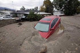
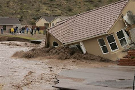
Creeks and rivers are nearing flood stage in California as another rainstorm pounds the area, prompting evacuations and stranding several thousand people in a remote hamlet.
Mandatory evacuations were ordered Monday afternoon for areas of Monterey County as water rose in the Carmel, Salinas, and Big Sur rivers as well as some creeks.
In Lake County, northwest of Sacramento, about two mobile home parks and nearby houses were ordered evacuated because nearby Clear Lake was a foot above flood stage.
County Sheriff Brian Martin says about 100 homes were affected but more homes along the 75-mile lake shoreline could face evacuation orders if the water keeps rising — and more rain is on the way.
Martin also says about 2,000 people in the remote community of Spring Valley are trapped because one of two entrance roads washed away and mudslides closed the other. Authorities hope to use a temporary bridge to reopen it in the next few days.
———
5:50 p.m.
Monterey County has issued mandatory evacuation orders for people living near creeks and rivers as a continuing downpour creates a threat of floods and mudslides.
TV station KSBW-TV reports (http://bit.ly/2m6cTci) that low-lying areas along the Carmel River were ordered evacuated Monday afternoon. The Sheriff's Office says it's using Humvees to help evacuate the northern county.
Firefighters also have evacuated homes in a Salinas neighborhood after Santa Rita Creek reached its peak.
In rural Royal Oaks, some residents had to be evacuated after a mudslide encroached on a home.
———
3:50 p.m.
Authorities say a pre-evacuation advisory has been issued for a California community in Madera County after water discharges from Bass Lake were increased and threatened to swell rivers.
The Fresno Bee reported (http://bit.ly/2m5S8NG) that the order was issued Monday for several roads near downtown North Fork, about 10 miles from the lake.
The sheriff's office says residents who live in the area should be ready to leave quickly if conditions worsen.
Downpours swelled creeks, lakes and rivers throughout Northern California, threatening to cause even more flooding in the already soggy region.
———
2:45 p.m.
Forecasters have issued flash flood warnings throughout the San Francisco Bay Area and elsewhere in Northern California.
The National Weather Service says heavy rain could persist into Monday evening and is expected to cause flooding on the Carmel River in Monterey County and Coyote Creek in Santa Clara County.
The weather service has also issued flash flood warnings for the North Bay and Monterey areas as well as south-central Alameda County and southeastern Santa Clara County.
In Alameda County, the weather service reported gauges on Alameda Creek are showing that rapidly rising water levels have surpassed local flood stages in Niles Canyon and a watershed above Sunol Regional Wilderness.
The warnings are in effect until late Monday afternoon.
———
1:45 p.m.
The National Weather Service has forecast heavy snow in the Lake Tahoe area with a high avalanche danger until Tuesday in an area of the Sierra Nevada from Yuba Pass to Ebbetts Pass.
Forecasters say the winter storm could drop up to 5 feet of snow in areas above 7,500 feet.
Lower elevations could see between 8 and 24 inches of snow.
The NWS is advising motorists to avoid travel in the area through Tuesday.
Moderate to heavy rain along with snow melt below 7,000 feet is expected to swell rivers and streams and increase the chance of flooding.
———
10:35 a.m.
Forecasters say rainfall in San Francisco has already surpassed the normal annual amount for the wet season that begins in October.
National Weather Service forecaster Bob Benjamin said Monday that the city has logged 24.50 inches of rain since Oct. 1.
He says the average rainfall for the year ending Sept. 30 is 23.65 inches.
Downpours swelled creeks and rivers Monday throughout Northern California, threatening to cause even more flooding in the already soggy region.
Close to an inch of rain had fallen in San Francisco. Santa Cruz County had seen 2.8 inches of rain in 24 hours and could see up to 8 inches before the storm passes. Marin County got 2.3 inches of rain.
———
8:55 a.m.
Heavy downpours are swelling creeks and rivers and bringing threats of flooding in California's already soggy northern and central regions.
The National Weather Service map shows floods, snow and wind advisories for the northern part of the state. The NWS has issued a flash flood warning for the Soberanes burn area in Monterey County.
Rainfall totals for the last 24 hours were close to an inch in San Francisco. Santa Cruz County had logged 2.8 inches but could see up to 8 inches of rain before the storm passes. Marin County saw 2.3 inches of rain. Winds could reach 60 mph in the San Francisco Bay Area.
About 150 miles north of San Francisco, the water level continued to fall at Oroville Dam, where a damaged spillway had raised major flood concerns and prompted an evacuation Feb. 12.
———
11:20 p.m.
Some Northern California residents are preparing for another powerful Pacific storm by patrolling levees for signs of danger, reviewing evacuation plans and filling hundreds of sand bags.
One resident near Tracy, which is 80 miles east of San Francisco, said that though the levees appear in good shape, they decided take charge after the San Joaquin River started rising.
The area saw rain and wind Sunday afternoon but forecasters said a storm packing a bigger punch will reach the San Francisco Bay Area overnight before moving to the Central Valley.
The San Joaquin River at a measuring station near Vernalis — about 10 miles southeast of Tracy — remained Sunday at "danger stage," meaning it keeps approaching the top of levees, said Tim Daly, a spokesman with San Joaquin County Office of Emergency Services.


