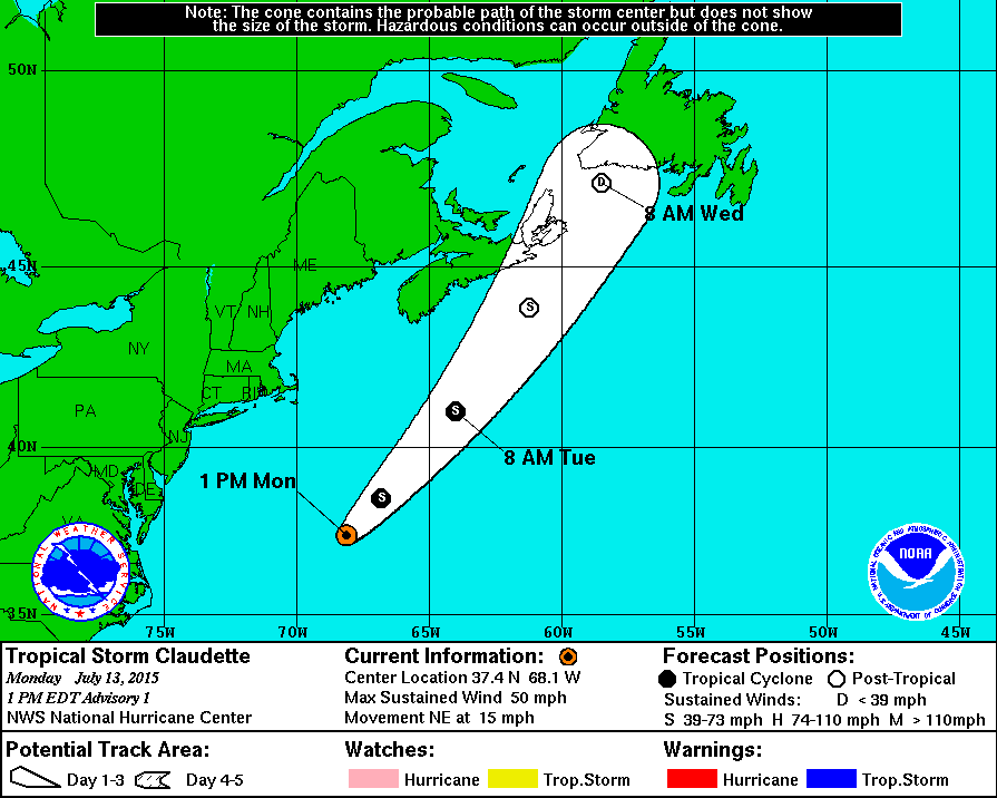
The third tropical cyclone of the hurricane season might be just around the corner, if the system can quickly capitalize on a favorable environment that’s not expected to last long.
A trough of low pressure swept east into the Atlantic off the North Carolina coast early Sunday morning. Since then, it has been moving eastward and gradually acquiring some tropical characteristics. As of Monday morning, it is located about 400 miles east of Norfolk, Va., and tracking east-northeast and out to sea.
This area of thunderstorms hasn’t become a fully-fledged tropical cyclone yet, but the National Hurricane Center is monitoring it for potential development, and has named it Invest 92L in the meantime. If the stormy area continues to become more organized it would be named Tropical Depression Three, or even Tropical Storm Claudette if its winds are strong enough. The Hurricane Center is giving the area a 40 percent chance of developing into a tropical cyclone over the next five days.
Thunderstorm activity in the area has increased and become centralized, both signs that it is shifting more into the tropical end of the cyclone spectrum. The sea surface temperatures under it are plenty warm to support tropical development today, but the wind shear is only marginally conducive for tropical cyclones. By Tuesday, though, both environmental conditions will become outright hostile.

Shear
and SST forecasts from the GFS global model for 92L. Note that by
Tuesday, shear increases to over 30kts, and SST decreases to under 26C…
and then GFS is unable to track a coherent vortex. (CIRA/RAMM)
 Average
seasonal progression of cumulative number of tropical cyclones in the
Atlantic, split into named storms, hurricanes, and major hurricanes
(Category 3+).
